Random Continent Generator: All 7 With Area, People and Highest Point

One press draws one of the seven continents, as a card with its area, 2025 population, number of countries, highest point and a globe, or as a slice on a wheel.

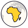
  1. Africa11.7 million sq mi. 1.55 billion people. 54 countries. Highest point: Kilimanjaro, 19,341 ft (5,895 m).
Saved

Seen 1 of 7

Tip: the space bar makes a new one.

Continent of the day


Random Continent Generator: All 7 With Area, People and Highest Point: how it works

A random continent generator has only seven answers, so each card adds a globe, the area, 2025 population, number of countries and highest point. In the list nothing repeats until all seven have come up. Switch to Wheel and all seven sit on a wheel to spin in front of a room.

Seven continents here, six or five elsewhere

This page uses the seven-continent model taught in most English-speaking countries. Schools in Greece and in many Romance-speaking countries teach six, with North and South America as one America. Russia and parts of Eastern Europe also count six, but join Europe and Asia as Eurasia. A five-continent count keeps the single America and leaves out uninhabited Antarctica.

How the countries on each card are counted

The counts follow the United Nations' regions and add up to 195: the 193 member states plus the Holy See and the State of Palestine. All of Russia counts in Europe, and all of Turkey and Kazakhstan in Asia. North America's 23 are Canada, the United States, Mexico, seven Central American countries and 13 Caribbean island countries.

Tips

  • Draw two and compare. Asia wins on area, people and highest point, and holds about 59 of every 100 people alive. On countries Africa beats it, 54 to 48.
  • For seven group projects, set the count to 7 and read the continents down your list of groups. The wheel never lands on the same continent twice running.
  • Plan an imaginary trip in two draws: continent first, then a country. Europe, Africa and South America have country pages here.

Questions and answers

Why does one card say Australia and Oceania?

Australia on its own is the smallest continent. New Zealand and the Pacific island countries lie far from any mainland, so atlases group them with Australia as Oceania. The card counts that whole region: 14 countries and about 47 million people. Its highest point, Puncak Jaya, is on New Guinea. Mainland Australia's is Mount Kosciuszko, at 7,310 feet.

Is Mount Elbrus or Mont Blanc the highest point in Europe?

It depends where Europe ends. Elbrus, at 18,510 feet, stands in southern Russia, about seven miles north of the Caucasus watershed. Run the boundary along that watershed, as this page does, and Elbrus is in Europe. Leave the Caucasus out and the title passes to Mont Blanc in the Alps, at about 15,770 feet.

Who owns Antarctica?

Nobody. Seven countries claim parts of it, but the Antarctic Treaty, signed by 12 countries on 1 December 1959, set those claims aside and keeps the continent for peace and science. It now has 58 parties. Nobody lives there permanently: about 5,000 people work at research stations in summer and about 1,000 stay through winter.
More like this

Random tool Browse Places

All 7 continents

A 4

  • Africa 11.7 million sq mi. 1.55 billion people. 54 countries. Highest point: Kilimanjaro, 19,341 ft (5,895 m).
  • Antarctica 5.5 million sq mi. No permanent residents. No countries. Highest point: Mount Vinson, 16,050 ft (4,892 m).
  • Asia 17.2 million sq mi. 4.84 billion people. 48 countries. Highest point: Mount Everest, 29,032 ft (8,849 m).
  • Australia and Oceania 3.3 million sq mi. 47 million people. 14 countries. Highest point: Puncak Jaya, 16,024 ft (4,884 m).

E 1

  • Europe About 4 million sq mi. 744 million people. 44 countries. Highest point: Mount Elbrus, 18,510 ft (5,642 m).

N 1

  • North America 9.4 million sq mi. 617 million people. 23 countries. Highest point: Denali, 20,310 ft (6,190 m).

S 1

  • South America 6.9 million sq mi. 438 million people. 12 countries. Highest point: Aconcagua, 22,838 ft (6,961 m).

How this list was compiled: The seven continents of the model taught in most English-speaking countries, a closed list; the six-continent and five-continent models in the x fields follow https://en.wikipedia.org/wiki/Continent. Areas are Britannica's, read from its articles for each continent (https://www.britannica.com/place/Asia, /Africa, /North-America, /South-America, /Antarctica, /Europe, /Australia and /Oceania-region-Pacific-Ocean) through the Internet Archive's copies of August and September 2026 (https://web.archive.org/web/2026/https://www.britannica.com/place/Asia and so on), because the live site refuses automated reading; the same figures appear in the table at https://en.wikipedia.org/wiki/Continent. Europe's and Antarctica's areas are round figures in Britannica and are marked x.areaApprox. Australia and Oceania is the sum of Britannica's Australia (7,688,126 sq km) and its Oceania without Australia (822,800 sq km), which Britannica words as 'excluding Australia but including Papua New Guinea and New Zealand'. Its Asia figure is worded 'excluding the island of New Guinea', so the Indonesian half of the island is in neither total as worded; both wordings were re-read in the archived articles on 2026-09-18. Populations are the United Nations World Population Prospects 2024, medium variant, for 1 July 2025 (file WPP2024_TotalPopulationBySex.csv at https://population.un.org/wpp/downloads, © United Nations, CC BY 3.0 IGO); North America is the sum of the UN regions Northern America, Central America and the Caribbean, and the world total used for x.popShare is 8,231,613,000. Antarctica's station numbers are from https://en.wikipedia.org/wiki/Antarctica the treaty dates and the seven claimant countries from https://en.wikipedia.org/wiki/Antarctic_Treaty_System, and the 58 parties (the 12 signatories plus 46 later accessions) from the Treaty Secretariat's list at https://www.ats.aq/devAS/Parties?lang=e. Country counts are this site's own count of the 193 UN member states (https://en.wikipedia.org/wiki/Member_states_of_the_United_Nations) and the two UN observer states, sorted by the regions of the UN M49 standard (https://unstats.un.org/unsd/methodology/m49/overview/): 54, 48, 44, 23, 14 and 12, 195 in all. M49 places all of Russia in Europe and Turkey, Cyprus, Georgia, Armenia, Azerbaijan and Kazakhstan in Asia. Highest points were checked against https://en.wikipedia.org/wiki/Seven_Summits, https://en.wikipedia.org/wiki/List_of_elevation_extremes_by_region and the article for each mountain (for the Europe question, https://en.wikipedia.org/wiki/Mount_Elbrus and https://en.wikipedia.org/wiki/Mont_Blanc), and compared with Britannica. Where sources differ the card gives the surveyed figure: Everest 8,848.86 m (2020, shown as 8,849 m; Britannica rounds to 8,850 m), Aconcagua 6,961 m (2012 survey 6,960.8 m; Britannica 6,959 m), Denali 20,310 ft (US Geological Survey, 2015), Kilimanjaro 5,895 m. The globe drawings are this page's own, drawn from Natural Earth 1:50m country shapes (public domain, https://www.naturalearthdata.com/) in an orthographic view centred on each continent. Russia is split along a hand-drawn line down the Urals, New Guinea is drawn whole with Oceania, and Hawaii, French Guiana, the French Caribbean and Indian Ocean islands, the Canary Islands and Madeira are drawn with the continent they lie in; Turkey, Kazakhstan and Egypt are drawn whole with Asia, Asia and Africa. The drawings are locators, not boundary statements. All checked 2026-09-18. Licence: own work (wording, country counts and globe drawings); areas as published by Encyclopaedia Britannica; population figures from United Nations World Population Prospects 2024, CC BY 3.0 IGO, https://population.un.org/wpp/; globes drawn from Natural Earth, public domain